• You are viewing the forum as a Guest, please login (you can use your Facebook, Twitter, Google or Microsoft account to login) or register using this link: Log in or Sign Up

New flood plain SUDS

Gill

Member
Joined
17 Mar 2008
Messages
3,916
Location
Coventry
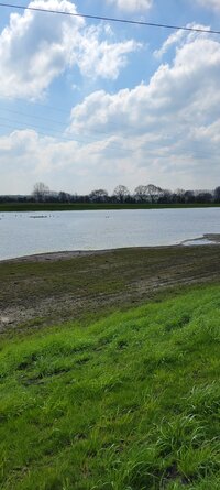
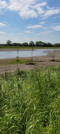
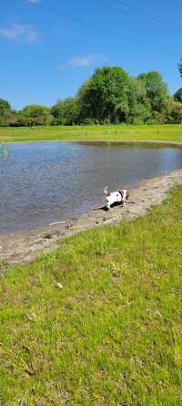
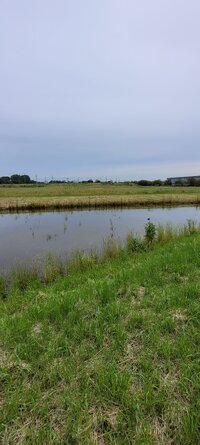
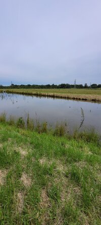
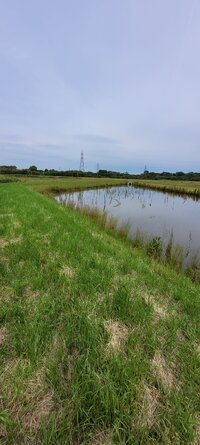
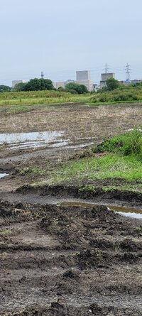
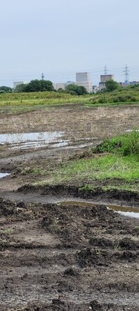
This is the new lake area as I call it that Rolls Royce have created near the new additions to the science park. And Nuclear sub division nearby. It used to be farm land attached to the local park, and you could walk across it as a short cut to Chellaston.
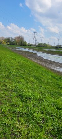
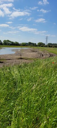
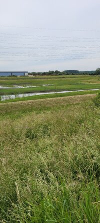
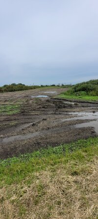
You can walk round the embankments and there are some areas that are covered In some springy thick matting, and others that have a concrete grid pattern.
The springy matting is in some of the dips, and wonder what purpose it serves.
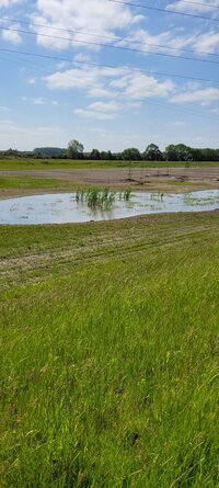
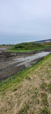
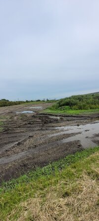
There are multiple connected areas with a very deep straight gulley that drains out into the surrounding area. Could not reach the areas to the far corners as was too muddy still.
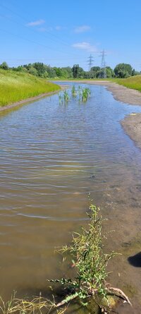
And they have concrete weirs to drain out into Hells Brook.

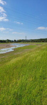
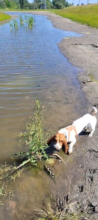
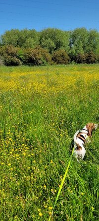
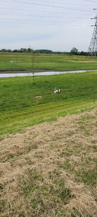
To the right of where Calcifer is, is a large Golf ⛳️ course.

Would you say:
Lake
Drainage lake
Large ponds
 

Attachments

  • 20230418_115620.jpg
    20230418_115620.jpg
    1.2 MB · Views: 160
  • 20230418_115624.jpg
    20230418_115624.jpg
    1.7 MB · Views: 103
  • 20230418_115628.jpg
    20230418_115628.jpg
    1.5 MB · Views: 103
  • 20230418_121724.jpg
    20230418_121724.jpg
    2.2 MB · Views: 99
  • 20230418_121726.jpg
    20230418_121726.jpg
    1.8 MB · Views: 97
The feature is part of a sustainable urban drainage system (SuDS) and it is used to manage floodwater. One of the problems engineers first faced when they designed and built these large exposed artificial embankments, was that rabbits and other mammals would quickly burrow into the soil, sometimes causing the whole embankment to destabilise and collapse during flood events... so they designed these mats (usually with a wire core) to stop any burrowing animals. Soon after, the mats also became more popular across the industry because plant (heavy machinery used to cut and maintain vegetation) was less likely to sink or get slowed by any deep mud.
 
Hi all,
The feature is part of a sustainable urban drainage system (SuDS)
I going to guess we will <"see some more of these"> for new developments via "Biodiversity Net Gain (BNG)".
<"Can SuDS help achieve biodiversity net gain?">.......So, what is Biodiversity Net Gain? Biodiversity net gain is an approach that mandates the need for a development to end up in a better position to support wildlife and habitats than it was before construction began. For some developers, net gain may seem like more red tape and planning hurdles curtailing their profitability, not to mention their freedom to deliver on the Government's equally forceful expectations for new homes and infrastructure.......
I've seen a few of these on new housing developments, they've ranged from woeful to dreadful, but are probably more successful than most of the other BNG schemes I've seen, mainly because it is difficult to mow a pond.

cheers Darrel
 
Last edited:
The feature is part of a sustainable urban drainage system (SuDS) and it is used to manage floodwater. One of the problems engineers first faced when they designed and built these large exposed artificial embankments, was that rabbits and other mammals would quickly burrow into the soil, sometimes causing the whole embankment to destabilise and collapse during flood events... so they designed these mats (usually with a wire core) to stop any burrowing animals. Soon after, the mats also became more popular across the industry because plant (heavy machinery used to cut and maintain vegetation) was less likely to sink or get slowed by any deep mud.

That explains it well then. Had wondered what the matting was for.
looking forward to seeing some heavy rains and how full they all become. And for all the wildlife it will encourage.
Hopefully we get swans back in the area after the oil spill of last summer in another housing development nearby drainage pond, And all the swans had to be moved away.
 
Sadly found out that this whole area will be closed off to access from the park. RollsRoyce will be putting in a hedgerow all the way round the park side to block access from it.
Alot of people are not happy, but when they say jump the council says how high.
So I will be using as much as I can till its closed off.
Foraged some bogwood to use in the future.
And saw they have planted trees in the water level, apparently they will thrive being in the water.

Was a shame seeing all the fish trapped past the weir, as the water has evaporated and just a fw puddles left. Could not get down Into to make a connection to the larger puddle with a stick for them to swim Into.

Dog ventured a bit further out Into the water today.
 

Attachments

  • 20230602_111338.jpg
    20230602_111338.jpg
    1.7 MB · Views: 70
  • 20230602_111341.jpg
    20230602_111341.jpg
    1.7 MB · Views: 78
  • 20230602_111539.jpg
    20230602_111539.jpg
    1.6 MB · Views: 65
  • 20230602_111541.jpg
    20230602_111541.jpg
    1.6 MB · Views: 69
  • 20230602_112230.jpg
    20230602_112230.jpg
    1,016.4 KB · Views: 71
  • 20230602_112232.jpg
    20230602_112232.jpg
    1.4 MB · Views: 70
  • 20230602_112538.jpg
    20230602_112538.jpg
    2.2 MB · Views: 71
  • 20230602_113306.jpg
    20230602_113306.jpg
    1.9 MB · Views: 65
  • 20230602_114227.jpg
    20230602_114227.jpg
    2.5 MB · Views: 70
  • 20230602_114353.jpg
    20230602_114353.jpg
    846.1 KB · Views: 67
  • 20230602_114526.jpg
    20230602_114526.jpg
    930.1 KB · Views: 64
  • 20230603_105954.jpg
    20230603_105954.jpg
    2.5 MB · Views: 67
  • 20230603_125803.jpg
    20230603_125803.jpg
    1 MB · Views: 66
  • 20230603_125805.jpg
    20230603_125805.jpg
    1.2 MB · Views: 60
  • 20230603_125808.jpg
    20230603_125808.jpg
    1,000.1 KB · Views: 62
Noticed alot of critters in the water. And what looked like scuds in large quantities.

Someone in a mobility scooter had to be rescued during the week, as they got stuck in the mud and their scooter sank stranding them. How they managed to drive their scooter down the steep hill that gives access to the lake without toppling over I don't know.
 
@hypnogogia historically this was all landfill and then farmland. AFAIK RR bought it many years ago. And in between all that, the land was used a shortcut to Chellaston from surrounding areas.
Don't know why they are closing it all off. just what the parks volunteers have been told. will ask for more info when i see them next.
This gives yo an idea of how much land RR own in Derby, this whole area below is the many factories and sites all in that area.
And then there are more dotted in the north of derby etc.
1685819847309.png

From the park you can see right across to the new iHub Building and the new Oregon building.
The flood plain sits in-between the park and the Oregon building.
The 2 red dots are where you can currently access the lake from the park using the trail people have been using for years.
Grey Dot is an access gate that is not in use due to overgrown brambles. And is in the Sinfin Moor nature reserve that is used for grazing rare breeds of sheep each summer, And Highland Cattle.
I have not walked around the whole area yet, as it is vast and so far its a 2k walk around where i have ventured the 1st green area. The Green Lines mark roughly the Embankments you can currently walk along with Gaps where heavy vehicles passed thru etc.
The Dark Blue line is the very deep trench dug out for water to feed the lakes.
The 2nd lake is called the swale and behind the New Nuclear division. And hope that. that will also remain open. As Alot of dog walkers/joggers etc park up and use that lake in the mornings. And alot of people in Chellaston use that lake.
1685821856619.png


HTH
 
@Gill I k ew RR were in Der y but had no idea of the extent of land and facilities they own. Thanks for the clear explanation and maps. A shame for walkers to loose some of their paths.
 
Went for a longer walk around it today and there is a whole other flood pain behind a row of trees. It's mainly been flattened but nothing else done to it.
And found the main sluese ( I thinks that's the word) gate for volume control etc.
There were a family of ducks and the dog was intrigued by them. Especially once the mother duck started doing the distraction technique so the ducklings could flee into the bull rushes.

They have started planting the hedgerow. I recognised the red Christmas berries and that about it. Lots of hedges mixed in. Prob will take them a while to complete the hedgerow and it to grow in to block it off. As the area to cover is vast.

Found another access point by the main drain nr to the Golf Club Boundary. So can use that aswell as that links to the trail. That runs parallel to the golf club and leads near to the park entrance.
Grass was being sown and more trees have been planted.
Could not see any fish at all in any of the lakes today, which was a shame. And not many birds using it, but loads of dragon flies hovering about and in the reeds.
 

Attachments

  • 20230623_103921.jpg
    20230623_103921.jpg
    1.2 MB · Views: 56
  • 20230623_102002.jpg
    20230623_102002.jpg
    1.7 MB · Views: 59
  • 20230623_102004.jpg
    20230623_102004.jpg
    1.6 MB · Views: 55
  • 20230623_102215.jpg
    20230623_102215.jpg
    1.9 MB · Views: 54
  • 20230623_103914.jpg
    20230623_103914.jpg
    1.2 MB · Views: 55
  • 20230623_103917.jpg
    20230623_103917.jpg
    1.3 MB · Views: 54
  • 20230623_104410.jpg
    20230623_104410.jpg
    1.4 MB · Views: 55
  • 20230623_104412.jpg
    20230623_104412.jpg
    1.4 MB · Views: 56
  • 20230623_104416.jpg
    20230623_104416.jpg
    1.2 MB · Views: 54
  • 20230623_104421.jpg
    20230623_104421.jpg
    1.8 MB · Views: 54
  • 20230623_104423.jpg
    20230623_104423.jpg
    1.8 MB · Views: 52
  • 20230623_105214.jpg
    20230623_105214.jpg
    1.6 MB · Views: 54
  • 20230623_103905.jpg
    20230623_103905.jpg
    2.5 MB · Views: 56
  • 20230623_103901.jpg
    20230623_103901.jpg
    2.5 MB · Views: 58
  • 20230623_103903.jpg
    20230623_103903.jpg
    2.4 MB · Views: 62
Back
Top